Sunday 30 September 2012

Pildappa Rock


Pildappa Rock Camp site at dawn
It’s a long way from Point Lowly on the eastern side of Eyre Peninsula to Venus Bay on the western side of Eyre Peninsula so we decided to stay a couple of nights at Pildappa Rock free camp. 


Southern face of the rock
 The rock is reached via 15 km of dirt road going north from Minnipa which is a small wheat town on Highway No.1 half way between Port Augusta and Ceduna. We were going to stay two nights before heading to Venus Bay but the weather forecast of 65 km winds at Venus Bay made us decide to extend our stay by one night.  We were hoping to get some shelter from the winds from the rock but still copped a bit of a battering. Pildappa Rock is similar in many ways to the better known wave rock at Hyden in WA and has extensive “wave” like rock fronts.
Camping under the southern cross
 It is quite amazing up on top of the rock with many indentations called gammets which hold water after rain. Some of these are quiet large and still had water in them when we visited. There are also remnants of a small dam wall on a couple of gammets which early settlers used to hold water longer. 
Flowers at the top
 
 
I was surprised to see wildflowers growing on top of the rock – tough little buggers!


We made the best of being stuck at Pildappa in the wind for a few nights by taking some time to explore some of the local attractions.
 
Wind sculpture - Tcharkuldu Hill
Nearby Tcharkuldu Hill near Minnipa was quiet interesting with a rock wall built around the bottom of the hill which acted as a water collection system as water flowed off the hill (smooth rocks). Must have been quiet efficient as this was originally the sole water supply for Minnipa. We also saw this system of water collection near Dalwallingu WA when we visited a couple of years ago.
 
 
Organ Pipes - Gawler Ranges
The entrance to the Gawler Ranges is 40 km by dirt road to the north of Pildappa Rock and we decided to venture out for a day with some guys we had met at the rock who travelling in motorhomes (had a young pommy guy they had picked up who was on a 3 month visa and was riding his push bike from Perth to Sydney – apparently got as far as the SA border before the roaring NE winds started pushing him backwards and he accepted a lift). As some of the roads were marked 4WD recommended we were there standby tow vehicle if they got stuck. Turned out that although the 4WD roads were badly rutted in places they 
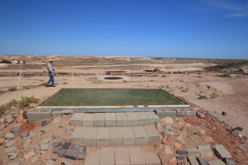
were Ok for 2WD motorhomes and we didn’t have to pull anyone out J.Whilst in the Gawler Ranges we visited the Organ Pipes, the Rock Dam and the Old Paney Homestead. Our motorhome friends were good company and we had a great day out. Have made a mental note to explore the Gawler Ranges further next time we are back in SA (when the bloody wind stops blowing!).


Yorke Peninsula


View of Black Point - our van under tree at right
Whilst on Yorke Peninsula we stayed for 8 nights at the Harvey Caravan Park at Black Point.  Great park with only 10 caravan sites with showers, toilets, water, power, and free laundry all for $20/night. Park was also absolute beach front and next to the boat ramp. It’s easy to get to know everybody when there are only a few campers and we had some great evenings around the fire (yep could even have fires in this caravan park) and one memorable afternoon where everyone cooked up some seafood – oysters, crumbed red-claw, King George Whiting, battered razor shell, and blue swimmer crabs – a real feast.
Nice for $20/night
Point Black’s magnificent sandy beaches stretched along three kilometres to the point and this was a great walk in the mornings.  After arriving we prepped the tinny and during the first afternoon I caught seven blue swimmer crabs and two big King George whiting. Unfortunately I forgot to put the keeper bag in the boat when I pulled up anchor and lost both whiting and bag – copped some ribbing from the rest of the campers for days after! In the time we were at Black Point we had two big feeds of blue swimmer crabs and put a few KG Whiting fillets in the freezer. On the last fishing day Linda and I were out in our tinny fishing next to the tinny of our neighbour in the caravan park - I threw over the anchor and found out that the shackle had come off - good bye anchor – I can still hear the laughing from other tinny – more ribbing that night!  Local oysters were only $10 a dozen fresh in the shell and were the best oysters I have ever tasted.

Beautiful coastline
We also spent some time touring around on the peninsula and you can see why people come here for holidays. The inland rolling countryside with its endless wheat and canola fields to the pristine blue waters of the southern ocean – make this a really pretty place. 

Southern Beaches
The peninsula has many small towns all of which seem to be dominated by pubs and churches (sin on Saturday and repent on Sunday J). All towns have a lot of history and some of the old stone buildings and churches are over 100 yrs old. We had some great counter lunches at some of the pubs and for around $10/head you could get a great meal.
 
 
On one of our days out down the south end of the peninsula we followed the scenic gravel coast road and was having a great time till we got a stake through our rear tyre – bugger! We changed the tyre and drove into Yorketown for lunch – the local tyre repair place closed at midday but typical of the country the guy came in on his afternoon off and fitted a new tyre for me.  
Edithburg Wind Farm
Now for the bad news – for the whole eight days and nights we stayed we copped strong to gale force winds for six of them.  Put up our awning when we arrived and spent all the night getting up every hour to check the ropes and fittings - trying to make sure it wasn’t going to blow away. Awning never went up again during the stay! For most days the wind put fishing out of the question and made life generally miserable around the campsite - never again will I travel to the peninsulas in SA during Spring.

 The Peninsula is a beautiful spot – just pick a month when it’s not windy to visit!


Sunday 23 September 2012

Lake Hart


1000 sq km of salt lake and Tammy finds a wheel to pee on!
On our way from Coober Pedy to the green sights of the Adelaide Hills we stopped one night at a free camp at Lake Hart.
Lake Hart at Sunset - no water all salt


Only a small campsite but scenic views over the lake from the elevated campsite. 
 
 
Part of old railway tracks into lake rocket launch site
Lake Hart is a large salt lake about 40 km from Woomera Township and has an interesting history. A Rocket launch facility was located on the edge of the usually dry Lake Hart. Originally built for testing the British Blue Streak ICBM, but after that program's cancellation it was converted for the use of the ELDO program. Only one of the launch facilities, LA6A was completed. Ten launches took place from 1964, but no satellite was orbited. Last used on June 12, 1970, and complex later dismantled.
 
 
The Adelaide to Darwin Railway runs around the lake
 
Nice spot and worth a night stopover.


Thursday 13 September 2012

White Man Burrows (Coober Pedy)


Coober Pedy is the biggest supplier of Opals in the world. Our first impressions as we came into Coober Pedy were not good – thousands of untidy large piles of dirt (called mullock heaps) surround and invade the town. The houses we could see were lacking a little “tender love and care” and there was not a bit of greenery to be seen anywhere. So after booking into the Caravan Park we went up to the local look-out before dinner.
 
The “big winch” tourist centre is at the top of the local look-out and the facilities have been let run down (sign saying the business was sale and all doors and windows shuttered up explained why). The local caravan park operators suggested we try “Tom and Marys Greek Taverna” for dinner and it turned out to be a great place to dine. Good food, good wine and friendly staff made it an oasis in the desert. Surprisingly it won first prize for its Prawn recipe in a international cooking competition (seafood 1000k’s from the sea – not bad).  Not so good was the Underground Café we went to that charged us $7.50 each for a mug of coffee – we must have sucker stamped on our forehead!
So with mixed feelings about the place we booked a 5 hour tour with the operators of the Caravan Park. It was a brilliant tour. Some of the highlights were:


Looking down from the 1st Tee
A visit to the Coober Pedy Golf Course - 18 holes – all desert gravel and oiled sand greens. The Tees have a patch of artificial grass to tee off and you are allowed to carry a small piece of artificial grass to hit off when you’re on the fairway. The first hole is a doozy – you tee off from the top of a hill and it’s a good 5 iron to the green 50 meters below and 180 metres away.


Wow
The Breakaways are isolated hills and valleys just outside of town.  
They call these contrasting hills "salt and pepper"
Extremely picturesque and luckily for future visitors the area has been given back to the traditional owners which means you will never see a mullock heap on this pristine area!


A tour through a disused mine and a underground house.  This part of the tour was sponsored by an Opal Shop and included a 15 minute movie about the history of opal and Coober Pedy. It is amazing how much dirt they move to find opal when they mine. The underground house was large, really comfortable and with 3 metre thick walls it is a shift workers dream – no noise and pitch black when the lights go out. There’s a lot of luck in opal mining and it’s no wonder that large mining companies have never seen this type of mining as a good investment.
Retail Therapy
On the way out Linda found a small opal ring she liked and we stocked up on opal earrings for our grand-daughters.


The Serbian Underground Church was built over 2 years by volunteer Serbian miners on their days off. 


It’s open to all visitors 24/7 as today the Serbian population in Coober Pedy has decreased to an extent that services are no longer conducted on a regular basis at the church.


More Mullock Heaps!
After the tour we picked up our Pizza’s from the Caravan Park Pizza Shop (apparently Yani the owner used to own a Pizza shop in Melbourne before he went mining in Coober Pedy and brought the caravan park) and had a glass of fine red. We left Coober Pedy next morning with a far better understanding of what makes the place tick.

Monday 10 September 2012

Ayres Rock and Olgas


Our first close up of Uluru
Like most tourists to the red centre a visit to Uluru (Ayres Rock) and Kata Tjuta (The Olgas) was on our must visit list. I was expecting to be a little disappointed due to the over commercialisation of the place as there are 5 Star Hotels, a fleet of AAT-Kings Tourist busses, spas and pools  and all the trappings of a expensive American style over the top style resort. And yes - sadly all the things I was concerned about are there (including 1000’s of people) But what I didn’t take into account was the raw natural beauty of the Rock and the Olgas. Unless they build a roller coaster over the top, a tunnel of love through the middle and water parks down the sides these sights are truly awe inspiring Aussie icons and the park is a credit to the park management.

The Rock, Olgas and pre-dawn moon
I got up before sunrise on our first morning at the Rock and followed a convoy of vehicles out to the designated “sunrise viewing” spot for cars (25km from the Yulara Resort Caravan Park). There were three busses and at least 25 cars at the viewing platforms by 0630. Unfortunately due to the smoke from many bush fires in the area the famous changing colours of the Rock as the sun came up didn’t really eventuate.  Still it was great to be up watching the sun rise and admire the Rock.


Weathering of the Rock
The base walk around the circumference of the Rock is about 12 km and Linda and I set off early in the day to beat the heat. It took us about 4 hours to do the walk as we took our time and soaked up the atmosphere of the rock.  It’s a brilliant walk with a nice wide flat path. On the northern side the path deviates away from the Rock about ½ km due to several indigenous sensitive sites but on the southern side you can get up close and personal with the Rock.
 
 
One cave looks like a love heart?
From a distance the Rock looks like a smooth damper but up close you can see the huge caverns and eroded areas.


The climb up the Rock
A lot of people go to Uluru to do the climb to the top of the Rock – I had all intentions of climbing the Rock but didn’t in the end because:

·         For most of the time the climb was closed due to strong winds

·         The traditional owners ask you not to climb the Rock due to cultural reasons

·         I chickened out – one small fence rail, a very steep climb, a long way down with no hand holds if you slip, and over 35 fatalities recorded on the climb – added up to a no go for me.


We shared aour table with visiting Brazilian Geogoligists
On our first night we splurged out and did the Sounds of Silence dinner on the sand dunes. An entrée of sparkling wine and canapés whilst watching the sunset over the Rock and Olgas and then a three course meal under the stars with fine food and wine wasn’t a bad way to spend an evening. A tour of the night sky with a guide highlighting some of the southern constellations and even Mars and Saturn was good entertainment. They had also set up two telescopes – one on a galaxy far far away (couldn’t see Luke Skywalker) and the other on Saturn – it’s the first time I have actually seen Saturn’s rings through a telescope. Bloody good night.


Walpa Gorge
On our second day we went the 45km to the Olgas – just as awe inspiring as the Rock and different due the massive valleys and gorges - it makes you feel pretty and small and insignificant as you look up at the 100’s of metres of conglomerate rock walls.


We walked the Valley of the Winds, had a bite to eat at the Sunset Viewing area (also the only place at the Olgas with toilets J) and then walked Walpa Gorge before heading back towards Yulara Resort 20 km for the sunset viewing.

Walpa Gorfge
 Once again the smoke haze from the bush fires made sunset poor conditions for photography but we did get to see 30-40 feral camels heading out for their evening feed.


Talking about wild life – we saw lots of small birds, camels, feral cats, rabbits and a lone euro (rock kangaroo).  Funny thing - we met Japanese, German, Greeks, Dutch, and Italians but never saw a European J J


 Mount Connor and bushfires
As the area around the Rock had just experienced the best season in over 20 years (in some places the grass was chest high) bush fires were becoming a common occurrence. The afternoon after we came in to the Rock the road was closed and as we left Uluru numerous bushfires threatened to close the road again. It was a relief when we turned northeast after Curtain Springs Station as there were several fires raging to the south and a strong southerly wind. There are going to be some serious fires at the end of next summer when everything has died and dried out.

If you are an Aussie – go to the rock, gently push your way into the crowds of tourists, and see one of our natural wonders of the world.


Tuesday 4 September 2012

Kings Canyon


Only cloud seen for weeks!
After we finally got away from Alice Springs we spent 1 night at a free camp (Kernot Range was a nice spot for a stop-over) then 4 nights at Kings Canyon Resort.  The Resort is only 10km from Kings Canyon and you look out over the Giles Ranges from your van site. Nice caravan park but everything is very expensive -  $42/night for powered site, $2.33/ltr for diesel, $9.00 for a stubby of beer, and at the general store $4.00 for a can of baked beans!! Luckily we had stocked up on most things at Alice Springs but we still had to buy some fuel as its quiet a drive in to the Resort off the Stuart Highway.  Kings Canyon was first seen by white men when Ernest Giles came this way. He named the Canyon after his brother-in-law and fellow explorer (must have been trying to keep in the good books with his missus after spending years away exploing Oz).
 There are three ways to see the Canyon: 


Look-out at end of Canyon base walk
Take the relatively easy canyon floor walk along the dry creek and look up at the huge sandstone walls of the Canyon and admire the amazing array of plants and trees in the valley floor.


I got up before sunrise the first morning we stayed to get some sunrise photos on the canyon walls – a bit of a waste of time as the canyon runs east-west and the north and south facing walls don’t get much of the early morning sun (should have slept in!).


You can just see the car park which is the start of the rim walk
Take the more difficult 3.5 hour rim walk which initially requires walking up a very steep path (500 steps) from the car park to the top of the canyon. 
 Linda was having trouble with a sore hip so I did this walk by myself. Travelling for over 15 months has certainly taken its toll on my fitness and it was a 25 minute haul to the top with 3 stops on the way up.
 
 
steps leading down into the "Garden of Eden"
Once you reach the top it is then a reasonably easy walk around the rim of the canyon through some mind blowing scenery.
A long way straight down from the cliff edge
At times it reminded me of the Bungle Bungles with its eroded rock domes and desert views but once you got close to the cliff face and looked up, down and across the Canyon it a different world.
 
 
The north wall
For the first time in my life I actually suffered from some mild vertigo at one of the loftier look-outs.


This is one of the most enjoyable walks I have done since leaving Perth and is on par with the gorges of Karijini.

The third way is to view the canyon, ranges and desert plains from a helicopter.  


Seemed bigger in the advertisment?
We had been planning to do this since deciding to come to Kings Canyon months back and figured what we had saved by free camping since we left Brisbane in May would pay for the flight (the caravan repairs and associated accommodation and towing costs on our second stay in Alice nearly put an end to this plan but luckily the Insurance Company came good and paid for most of the costs).


The view at 3500 ft
Seeing the Canyon, Katherine Springs, and the Giles Ranges from up to 7000 ft was a ride to remember. Linda was more than a little worried about spending ½ an hour at 5700 ft in something small that doesn’t glide J but once we were up in the air we both thoroughly enjoyed the flight.  


Linda’s eagle eyes spotted some brumbies and feral camels (price of beer out here it helps to be a camel) out on the open plains.


The "Bungle Bungle" like bee-hives of the upper plateau
Kings Canyon is almost a 900 km diversion off the Stuart Highway as you head south from Alice Springs (half of which you have to do anyway to get to Uluru), it’s expensive but worth the trip in for the unique scenery.


Kings Canyon now ticked off the bucket-list J.